Survey Coordination Tool
The AusSeabed Survey Coordination Tool was developed to support coordination of survey activities across the Australian seafloor mapping community. Access to the Survey Coordination Tool requires a simple registration process. Governmental and academic entities, and others conducting seafloor mapping surveys can consider the areas of interest during mapping planning activities. ASB encourages collaboration and leveraging of opportunities based on common interests. The three tools contained within the SCT are independent of one another. The ASB SCT was developed by FrontierSI on behalf of AusSeabed.
- Survey Plans – Communicate planned mapping surveys to notify the seabed mapping community. This initiative aims to increase collaboration to optimise the use of national resources and seabed mapping efforts. It is hoped that with this knowledge, more collaborative surveys might be possible where surveys are extended or planned jointly to maximise survey time relative to transit. Information entered into the tool appears in the AusSeabed Data Portal.
- Areas of Interest – Identify your organisation’s marine area of interest to raise awareness with the marine community and enhance efforts to increase collaborations. These areas of interest will help inform future prioritisation of national seabed mapping efforts. Information entered into the tool appears in the AusSeabed Data Portal.
- HIPP Request submission – The Australian Hydrographic Office’s HydroScheme Industry Partnership Program (HIPP) is the commercial acquisition program that undertakes focused hydrographic survey activities to support national charting priorities and safety of navigation. For more information, please visit The Australian Hydrographic Office.
If you would like further information on the SCT, please contact us on ausseabed@ga.gov.au.
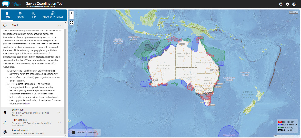
AusSeabed Survey Coordination Tool landing page, showing Areas of Interest. Submissions for Survey Plans, HIPP Requests, and Areas of Interest take place here – simple registration is required for access
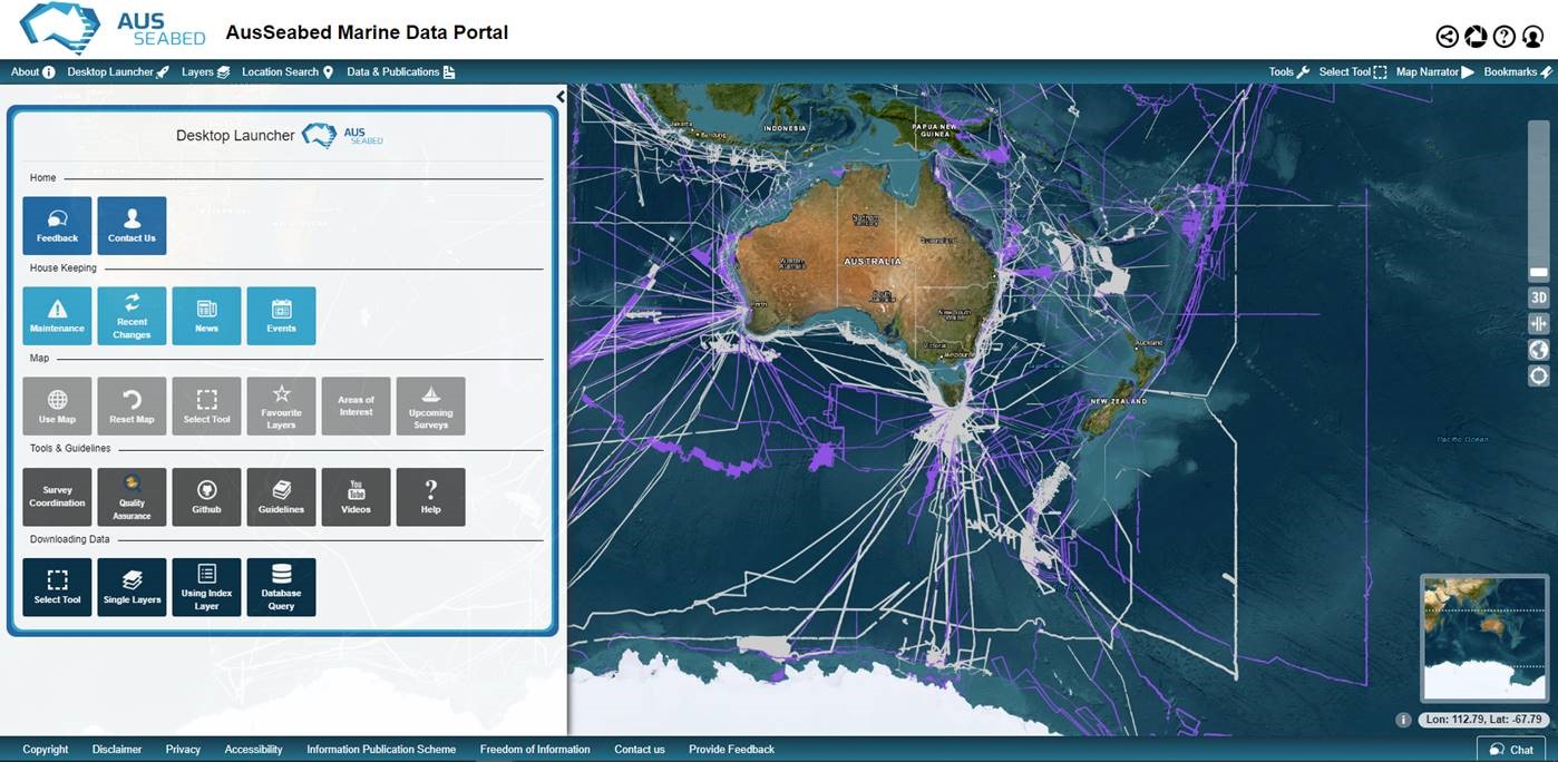
AusSeabed Marine Data Portal landing page displaying Desktop Launcher, and Survey Coverage layer.
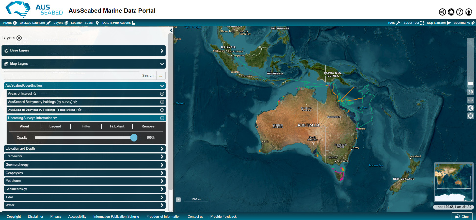
AusSeabed Marine Data Portal displaying Upcoming Surveys