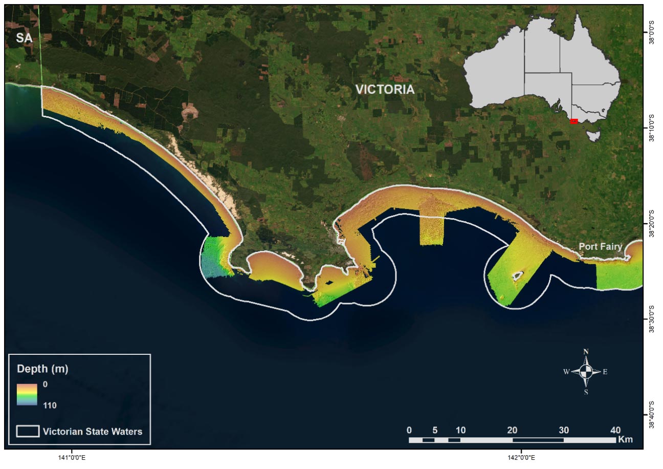
Extending mapping efforts along southwest Victoria
Deakin University’s Marine Mapping Group has recently received funding to continue their mapping efforts in the state of Victoria. This funding was provided by the state government Department of Energy, Environment and Climate Action and industry partner Garmin and will be used to extend mapping and continue filling in gaps in state waters along the southwest coast of Victoria between Port Fairy and the South Australian border (Fig 1). The team will be using their research vessel Yolla, which is based in Warrnambool and outfitted with a Kongsberg 2040c sonar system. Yolla is one of the most sustainable and economical seabed mapping vessels in Australia and, as a trailerable vessel, can be transported and launched from strategic ports across the state.
The data collected in this campaign will extend the seafloor mapping coverage from the Victorian Coastal Monitoring Program to continue to advance our understanding of the offshore sediment supply needed for the beaches. It will also be used to assess how the changing climatology and resultant changes in the wave conditions are impacting the coastlines in the region. Additionally, these maps will help to improve conservation planning, fisheries management, and infrastructure planning to limit impacts on the environment. Previous mapping discoveries have included unknown ‘gardens’ of magnificently coloured sponges, seaweed forests, seagrass meadows, shipwrecks, the Tyrendarra lava flow extending out from the shoreline, and submerged river systems and lagoons that would have supported Indigenous communities at lower sea levels. For some areas, this is the first information that has been obtained since Matthew Flinders took depth readings from his boat, the Investigator, in 1803.
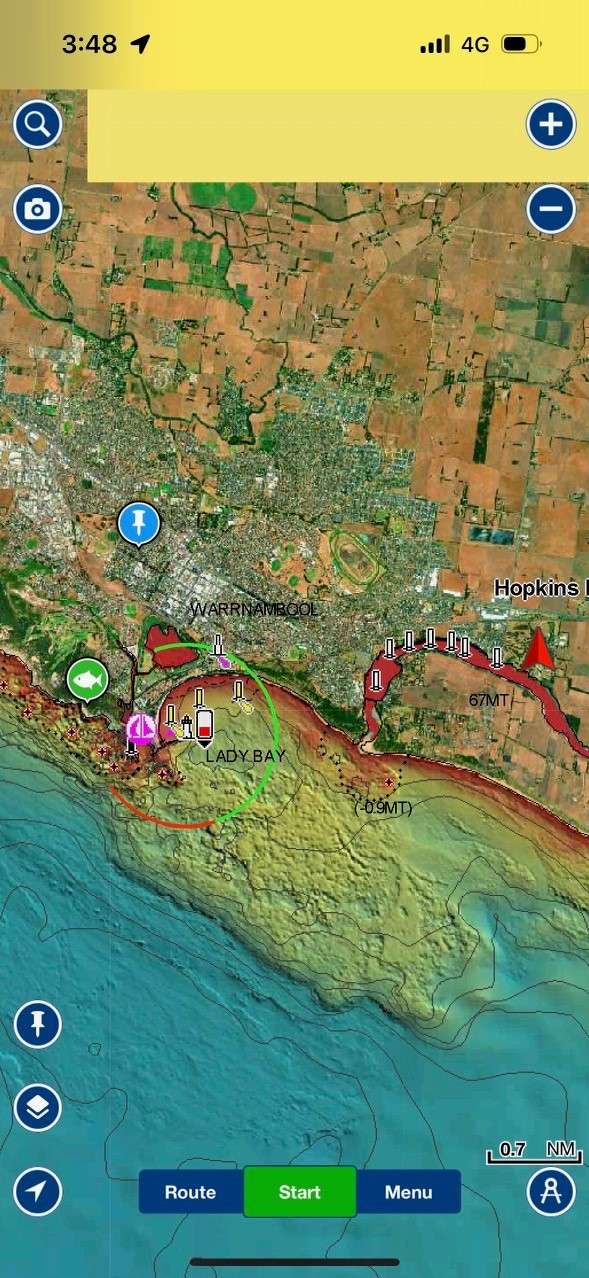
Once collected these data will be published on AusSeabed and also supplied to Garmin to integrate into Garmin Navionics where users can view the structure of the seafloor they are navigating over (Fig 2).